Africa
In recent years, BfN’s work in Africa has also involved facilitating projects on other topics, such as sustainable use of the medicinal plant Devil’s claw, tracing the origin of illegally traded ivory and supporting the "Cotton made in Africa" initiative. At present, BfN supports projects involving the use of available remote sensing tools in managing natural resources.
Promoting UNESCO Biosphere Reserves in southern Africa
As model regions for sustainable development, biosphere reserves can play an important role in achieving the 17 Sustainable Development Goals (SDGs). By protecting nature in the core area of biosphere reserves, natural resources can be conserved now and for future generations. Nature-friendly, income-generating measures in the transition areas of biosphere reserves and educational programmes provide perspectives, especially for young people. In close collaboration with African partners and the German Commission for UNESCO, BfN assists both the establishment and management of biosphere reserves, fosters exchange between and regional networking among stakeholders, and the identification of best practices in southern Africa.

Management Manual for UNESCO Biosphere Reserves in Africa
By supporting the development of a management manual for biosphere reserves in Africa, BfN has made it easier for practitioners to implement the UNESCO Man and the Biosphere (MAB) Programme.
The extensive manual was written by a team of African experts and compiled by the German Commission for UNESCO. It contains a wide range of helpful suggestions and recommendations on specific management issues, such as sustainable resource use, risk and conflict management, planning and participation. The manual is available in English, French and Portuguese, and there is also an abridged version.
UNESCO Biosphere Reserves – Pilot sites for bird monitoring and conservation in Africa (AfriBirds)
The project, which ran from 2016 to 2019, was conducted by NABU and BirdLife with the support of AfriMAB (the regional biosphere reserve network for Africa).
In a participative process involving representatives from African biosphere reserves, a bird monitoring methodology was developed and subsequently tested, adapted and implemented by BirdLife partners and state-run organisations in Nigeria and Cote d’Ivoire. The methodology is available as part of a monitoring toolbox which is freely accessible in the form of an online module.
UNESCO Biosphere Reserves – Establishment and development in Ethiopia
Ethiopia is one of the most populous countries in Africa. The rapid growth in its population places tremendous pressure on the country’s natural resources. For example, in the course of the last century the area of forest land has reduced from approximately 40 percent to just three percent of total land surface. The country’s wild coffee forests have also been affected. The coffee plant has its origins in the Ethiopian highlands.
Today, wild coffee varieties provide a genetic pool for modern coffee breeding. To protect Ethiopia’s remaining wild coffee forests and achieve their sustainable use, BfN has worked for the past 15 years with various Ethiopian and German partners. Activities mainly focused on establishing and developing UNESCO Biosphere Reserves.

Using remote sensing for wetland management in Africa
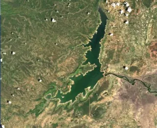
One current area of BfN activity in Africa involves promoting the use of remote sensing in the management of ecosystems such as wetlands. For example, managers can use freely accessible satellite data to classify wetlands, map land-use changes, assess risks and trends, and improve both planning and communication of the measures needed. Together with African experts, and as part of a BfN-supported project, a consultation and capacity development workshop was held, and an English-language manual compiled.

Project "Earth Observation in Africa: Capacity building for the conservation of ecosystems and their Services
The project "Earth Observation in Africa: Capacity building for the conservation of ecosystems and their Services" (EOCap4Africa) aims to strengthen the capacity of future researchers and protected area managers to utilise remote sensing data for the protection and sustainable use of ecosystems. A remote sensing learning module will be developed with a specific focus on wetland monitoring, in close collaboration with four partner universities from Ghana, DRC, Rwanda and Botswana.
