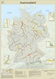
Floodplain status

Map as PDF
Map content
The floodplain status measures the extent of changes to the specific characteristics of the active floodplain, including the intensity of use and biotope structure of the active river floodplains with their frequently and rarely inundated areas. There are three assessment categories, called functional units that include the following criteria: 1. morphodynamics, floodplain profile and floodplain waters, 2. hydrodynamics, drainage and inundation and 3. vegetation and land use. The potential natural floodplain status that would occur in the absence of land use (Koenzen 2005) is used as reference status for the assessment of the floodplain status.
The area of investigation relates to the floodplains of 79 rivers with a total length of 10,297 river kilometres. The study area of the individual rivers begins in each case at the point of the river where the catchments exceed 1,000 km². Areas closer to the source and tidal areas were not surveyed.
Map display
The map shows the assessed 1-km floodplain sections proportionally to their area – separately by left and right bank. In addition, the dimensions of the former floodplains that are not assessed in terms of their status, are shown proportionally to their area, so that a reference to the respective loss of inundation areas can be established. This allows the quality of the active floodplains, the floodplain width and the floodplain loss to be intuitively mapped.